When the Snow Melts - Spring Hiking in Waterville Valley
Snowsport enthusiasts always lament the conclusion of winter. But here in the Valley, it's easy to welcome a new season of outdoor fun and exploration. When the snow melts in Waterville Valley, nature's extraordinary comeback begins.
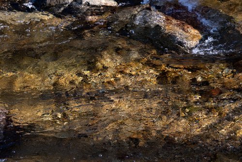
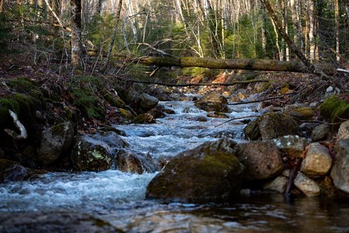
As the days get longer and warmer, winter slowly concedes its claim to the Valley. Bit by bit, day by day, the Valley slowly transforms into a Springtime spectacle. Bright buds garnish the beech, maple, and birch trees. Hundreds of wildflowers sprout up, blanketing fields and meadows and embellishing footpaths and hiking trails. Snowmelt provides the Valley with gushing waterfalls, surging rivers, and crystal-clear plunge pools.


Spring hikes are a superb way to appreciate the splendor of springtime. Trailheads are quiet - much quieter than in the Summer and Fall months. This allows you to get some quality, 1-on-1 time with the surrounding forests and mountains. Along your hike, the only sounds you'll hear are that of Mother Nature - birds tweeting, water babbling, and the quiet thuds of your own footsteps. Peacefulness and serenity are palpable.
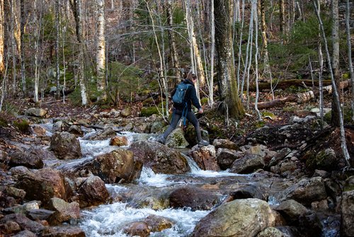
Hiking to higher elevations allows you to gain different perspectives. Down on the Valley floor, you'll find very little evidence of winter. But in the shady patches of Mount Tecumseh, there are sections of trail where snow still stands up to a foot deep. As you hike up, you'll discover that winter still thrives in higher elevations. Certain trails still have a lot of ice on them, so if you're hiking up beyond an elevation of 2,000-feet, we recommend bringing ice spikes, YakTraks, or crampons.
BEST SPRING HIKES IN WATERVILLE VALLEY

MOUNT TECUMSEH
Distance: 4.9 Miles (round trip)
Elevation Gain: 2,283 feet
Time: 3-4 hours
Highlights: viewpoints, brook, rapids, cascades.
The Mount Tecumseh Trail is a difficult, rocky trail leading you up to the Summit of Mount Tecumseh. The trail begins at the north end of the Waterville Valley Ski Area parking lot. We recommend parking in the north end of Lot #1. The trail follows Tecumseh Brook, and you'll cross the brook twice before you hit your first viewpoint.
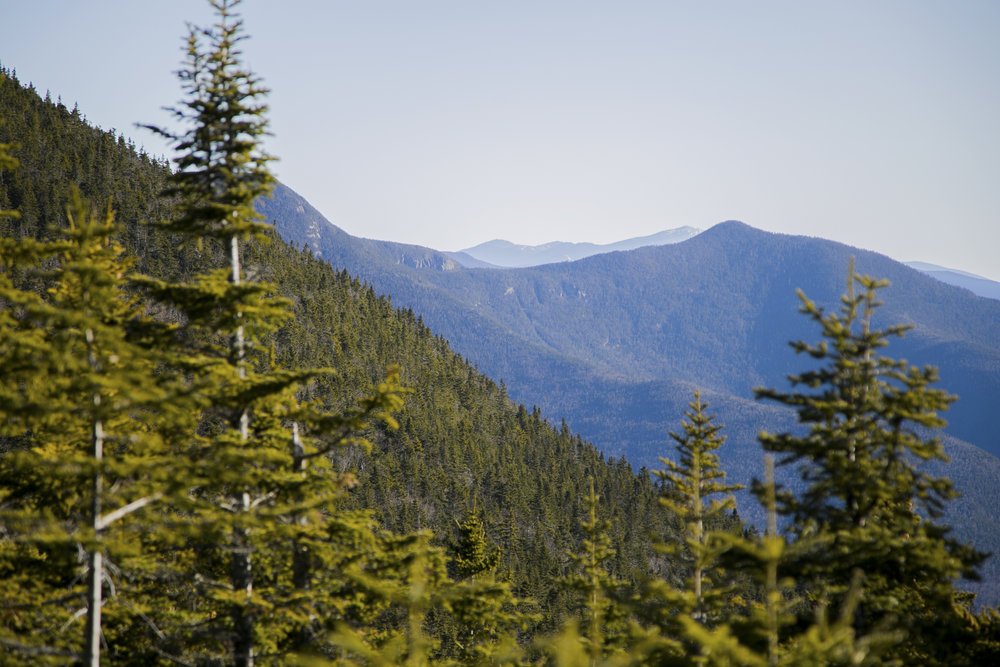
After your second brook crossing, there is a short spur path on the left that will take you to the ski trail Periphery, providing a beautiful view of the ski slope, surrounding mountains, and Valley. About a mile after that, the trail diverges. We recommend bearing left at the fork, following The Sosman Trail, which traverses Mount Tecumseh's ridge and provides excellent views to the east. The trail will lead to the cell tower at the top of High Country, where you can bask in panoramic views of the surrounding White Mountains.
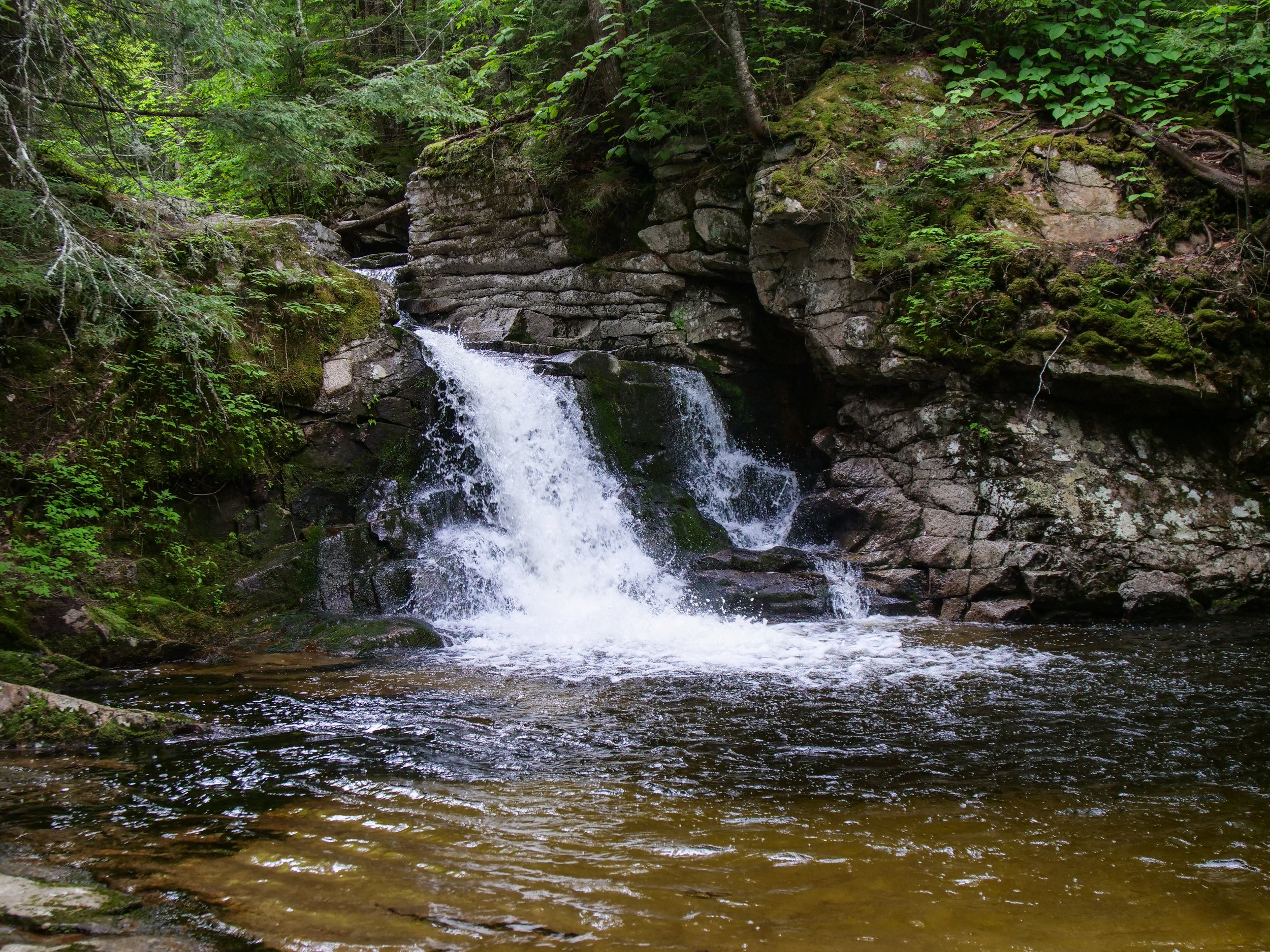
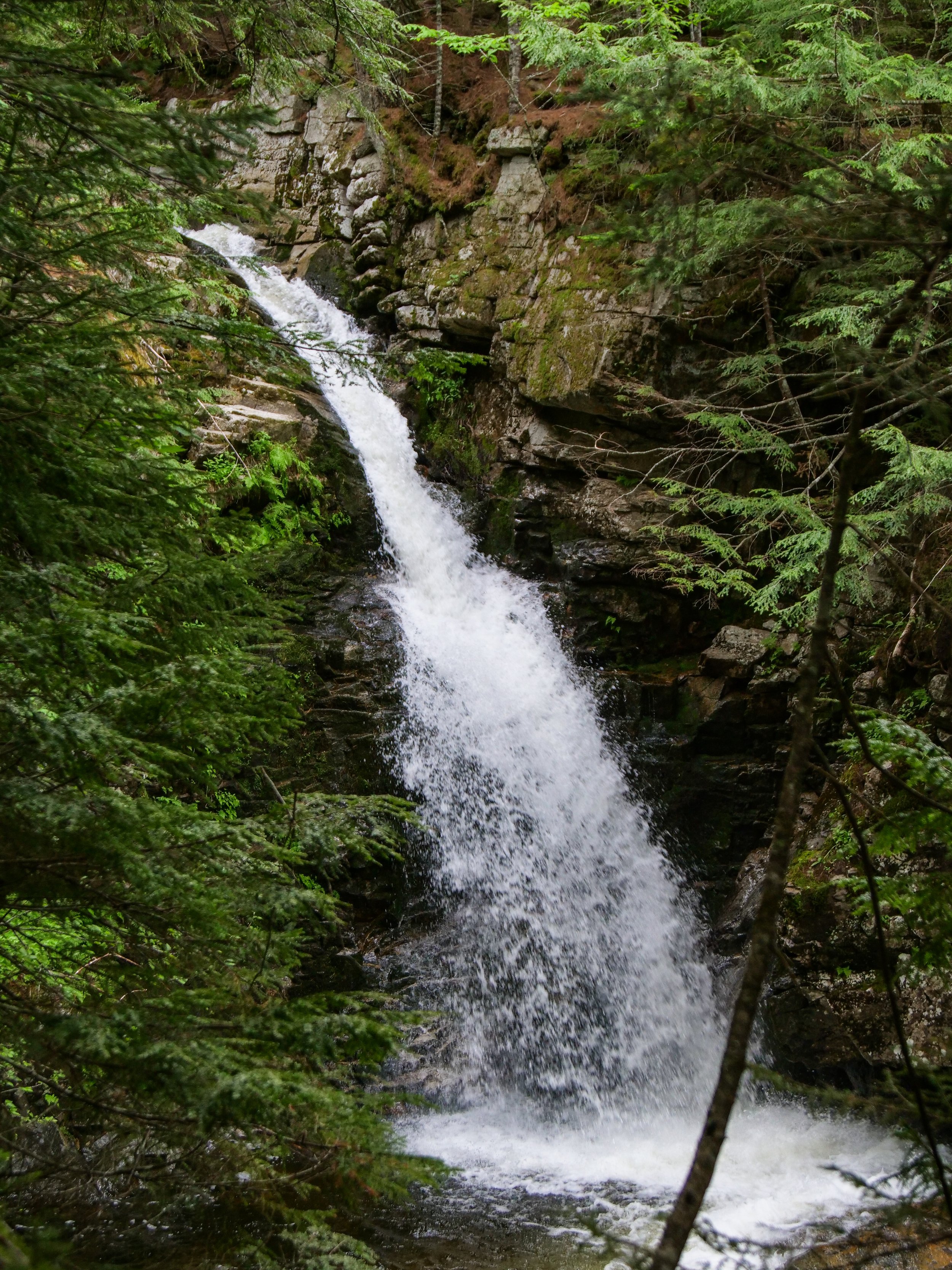
CASCADES PATH
Distance: 3 miles (round trip)
Elevation Gain: 540 feet
Time: 1.5-2.5 hours
Highlights: Waterfalls, cascades, plunge pools, brooks.
Start your hike at the Snow’s Mountain Parking Lot. We recommend parking in the north end of the lot, furthest away from the chairlift. From here, you will walk across Cascade Ridge Road to begin the trail. There is a sign marking the trailhead. Next you will walk up a grassy hill following the curves of the road. After entering a wooded section there will be a fork in the trail in front of a large house, you will stay right. The trail continues up the hill and crosses the road before joining an old ski trail on Snow’s mountain. Continue to follow the trail until it forks again, there will be a Cascade Path sign marking the left path. The trail begins to rise and winds through the forest as you cross the Swazeytown cross country ski trail. From here you will continue uphill for a moment before spending a good distance gently meandering downhill, passing an intersection with the Elephant Rock hiking trail.
1.2 miles into your hike the trail joins with the Lower Snow’s Mountain trail near a small bridge. Take a right and cross the bridge, following the trail for a couple of hundred feet until you come to the next bridge. Just before it, you will see another Cascade Path sign where the trail branches off to the right. After 0.2 miles you will come to the first in a series of waterfalls and gorges. The trail splits at the first waterfall, you can hike up either side of the brook. Both sides offer unique and fantastic views of the cascades and the pools below. The trails terminate after 0.3 miles, meeting at a large bridge on the Upper Snow’s Mountain trail. From here you can continue down the other side of the brook and head back the way you came or you can use the Snow’s Mountain Trail to explore other areas.

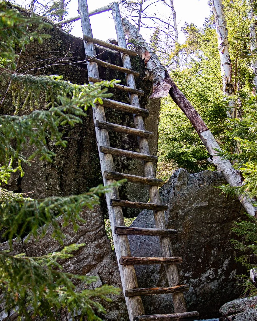
GOODRICH ROCK
Distance: 4 miles
Elevation Gain: 740 feet
Time: 1:45 to 2:45 hrs
Highlights: Viewpoint, ladder-climb, brooks, meadow.
The hike to Goodrich Rock begins in the Livermore Road parking lot. Walk past the information stand and fee area and turn left down the gravel path. After a short walk you will reach a small meadow with an intersection. You will then continue straight through the meadow, over a bridge, and back into the woods. Almost immediately after crossing the bridge you will take a left onto the Greeley Ponds Trail.
The straight path, lined with pine trees, gently slopes uphill until joining with the banks of the mad river. Shortly after this, you will see the Goodrich Rock Trail on your left. The narrow trail climbs somewhat steeply up to a set of stone and wooden steps. From there it levels off, crosses a small brook, and leads you to the Davis Boulders. The trail winds through broken-open chunks of granite and under a cave-like passageway. After passing through the boulder field, you will re-enter a conifer forest. When Goodrich Rock comes into view, the trail will circle around the backside of the rock leading you to a wooden ladder. Climb up the ladder to the top of Goodrich Rock and enjoy the views of Waterville Valley Ski Resort, Tecumseh, the Sandwich Range, and the valley below. As this is a frequently traveled destination, hikers are asked to be careful of the outcrop communities of lichen and balsam trees growing in this precipitous habitat.

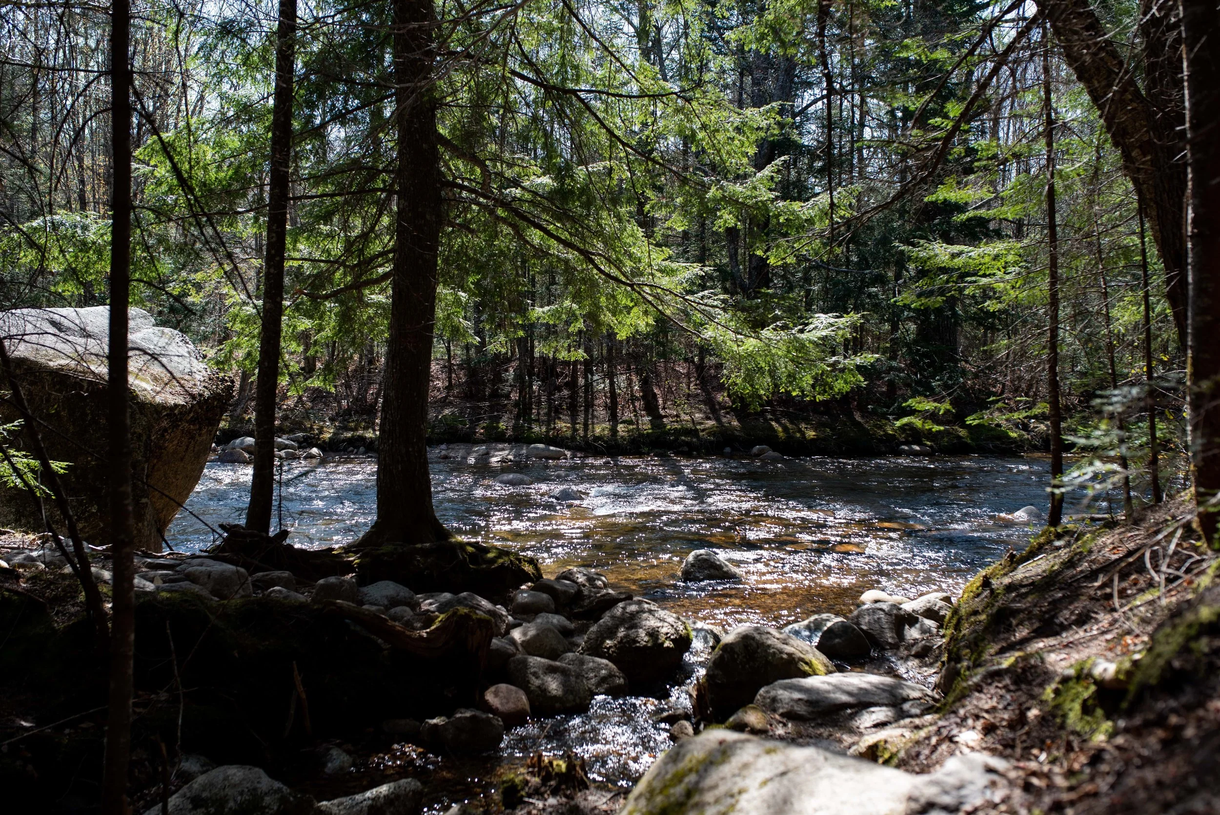
MAD RIVER TRAIL
Distance: 1 mile (one way)
Time: 30 minutes
Highlights: River crossing, rapids, easily accessible.
The Mad River Trail is a fun, easy trail that showcases the famous Mad River. From Town Square, cross the dam and turn right on the Village X-C Ski Trail, follow the trail through the tunnel, and then turn right on a bridge over Snows Brook. Continue straight over a second bridge, this one over the Mad River.

To the right of where the ski trail rises up the hillside, the Mad River hiking trail leads into the woods. After a small bridge and a series of steep rock steps, the trail walks along the high and steep-sided glacial riverbank. It soon descends steeply on another long series of wooden steps, down to the river’s shore, crosses a rill without a bridge; and then, crosses over a small footbridge, and a larger footbridge at the confluence with the West Branch of the Mad River. The final section easily traces the river and ends at West Branch Road.
P.S. Think Snow!